

Gas supply and Open BIM Gas Supply are the same tool. They have been conceived for the calculation, design, verification and automatic sizing of gas networks, whose aim is to get the gas to each consumption point. Additionally, they can read topographic terrain models in IFC4 format.
In the 2019.e version of CYPE software, its "suite" of urban infrastructure programs (Water Supply, Sewage, Electrification and Gas Supply) is included in the Open BIM workflow. From then on, the "suite" can be accessed, as it could until now, from the CYPE program menu (with its classic name); and as programs that can be downloaded from the "BIMserver.center" platform:
- Open BIM Water Supply
Can be installed in Spanish, Catalan, French and Portuguese - Open BIM Sewage
Can be installed in Spanish, Catalan, French and Portuguese - Open BIM Electrification
Can be installed in Spanish, Catalan and Portuguese - Open BIM Gas Supply
Can be installed in Spanish, Catalan, English and Portuguese
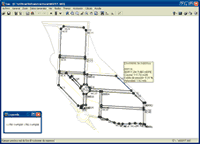
Program properties
The consumption can be entered as flow or as heat power to be installed at the node. In installations with combustible gases, the consumption at a node can be expressed as heat power. However, for industrial consumption or large commercial areas, the total consumption will be calculated as the direct sum of the consumptions of the appliances.
The installation is designed according to the types of pipes, diameters, required flows (or heat power) and supply pressures. The drops in pressure are calculated using the Renouard formula. The minimum pressure and the maximum velocity are limited.
Topographic terrain models can be read in IFC4 format, if the project is connected to a BIM model located in BIMserver.center that contains the IFC4 file with the terrain data defined in an entity such as "IfcGeographicElement”.
Open BIM workflow
Using Open BIM technology,it is possible to implement a collaborative, multidisciplinary and multi-user workflow to develop projects in an open, coordinated and simultaneous manner between the different technical agents that are involved.
Furthermore, by including "Gas Supply" or "Open BIM Gas Supply” in the Open BIM workflow, an IFC4 file that includes the topographic model of the land defined in an entity of the type "IfcGeographicElement" (like the rest of urban infrastructure programs of CYPE) can be imported.
The only difference between the classic infrastructure program versions and those that can be downloaded from the BIMserver.center platform, is that the connection to a BIM model is optional for the classic programs and those of the BIMserver.center platform must be connected to a BIM model.
Bear in mind that the connection to the BIM model of a project (which is possible from both versions of the program) only has advantages and no inconveniences. The connection to a BIM model does not imply the working mode has to be changed during the introduction, analysis or design of the project nor to obtain the installation documents:
- If there is no connection with a BIM model (only possible from the classic version of the program), the terrain topography cannot be read automatically and the possibility to work in a collaborative, multidisciplinary and multi-user workflow is lost.
- If there is a connection with a BIM model, users have the option to import the topography of the terrain and to work in a collaborative, multi-disciplinary and multi-user workflow.
From the program, users can connect to an existing BIM model on the BIMserver.center platform or create a new empty project, to which any other specialties that intervene in the project can be incorporated at any moment (water supply, sewerage, electrification, structure...).
Main advantages of including the project in the Open BIM workflow
Some of the great advantages the Open BIM workflow provides to CYPE infrastructure programs include:
- Import the topographic model of the terrain
If an IFC has been imported with the topographic model of the terrain, it will appear on-screen represented with contour lines and when the nodes of the network are introduced, the elevation of the terrain will be used to place them automatically, greatly helping to define the network. Remember that this is possible if the IFC is an IFC4 that contains the terrain data in an entity of the type "IfcGeographicElement". If the geometry of the terrain is also to be visible in the 3D views of the program and in the 3D viewer of BIMserver.center, the IFC4 must have an associated GLTF file that includes that 3D view. - Import the 3D view of other specialisations
If there are other infrastructures, in the BIM model of the project, or any other technical aspects of the project (water supply, sewerage, electrification, structure ...), the program can import its 3D view. With the joint visualization of the gas supply installation and other technical installations, users can detect if there are any collisions at a glance. - Export the documents and the 3D view of the installation generated by the program to the BIM model
All the documents generated by the program are exported to the BIM project located on the BIMserver.center platform (reports in "pdf”, plans in "dxf" and 3D view in "gltf"). Export to the BIM model is only carried out when the user selects the button.
 - Update the information imported from the BIM model
The program will notify the user when there are any modifications or new contributions to the BIM model from other technical areas (the button will be flashing). The user decides when the information is to be updated.
 - Delimitation of responsibilities
The documents that are exported to the BIM model are identified with their author, so the responsibilities of all the technical agents involved in the project are clearly defined. - The project that is introduced in the program is not exported
The installation that is introduced in the program will remain on the hard drive of the author or wherever it is copied to. Only the documents generated by the program are exported. - Lost internet connection
If at any time the Internet connection is lost, users can continue to work with their work, since it is located on their hard drive. The only thing that cannot be done, whilst there is no internet connection and once the project has been started, is to update imported data or export documents to the BIM model.
Project documents
In addition to the results that can be viewed on-screen (node analysis data and span analysis data with results by loadcase, combination or envelope), the program generates the project documents detailed below (reports and drawings). These documents can be printed from the program, exported in various formats and exported to the BIM model hosted on the BIMserver.center platform if the projectshas been connected to a BIM model.
Reports
- Design report
Description of the gas network and materials used, description of the terrain, formulas, combinations, list of nodes, list of spans, envelope, quantities and excavation quantities. - Node results
Node numbering, coordinates, installed flow, demanded flow, piezometric height and available pressure. - Span results
Length, diameter, installed flow, demanded flow, flow, velocity and losses.
Drawings
- Installation drawings
- Quantity tables
- Excavation tables
- Information on results by loadcase, combination and envelopes for:
- Nodes: flow (power), supply pressure, elevation, ground elevation, node pressure.
- Spans: dimension, material, flow, pressure drop and velocity.
Commercialisation of urban infrastructure programs
The urban infrastructure programs are commercialised in two ways:
- Urban infrastructures
- Urban infrastructures LT
Includes the same tools and same operation as the complete version, but the maximum number of nodes that can be introduced is limited to 50.
Tel. USA (+1) 202 569 8902 // UK (+44) 20 3608 1448 // Spain (+34) 965 922 550 - Fax (+34) 965 124 950